 Lost again? Trying to find someone's house in Asan, you're bound to knock on a few wrong doors. Usually, after panicked phone calls, the host ends up coming to the west side of Taleju temple to pick you up.
 Either try to find a travel agency in Samakusi. Your directions will be: "Come down near the pipal tree, walk up to the Bhagwati temple past the garbage dump, and ask the pasal ko didi for the house with the green gate, or just give a call."
But good news is around the corner: Kathmandu Metropolitan City (KMC) has launched a new metric addressing system which should reduce the hassle of trying to find your way around Kathmandu. Each house within the municipality area will have a number, based on its metric distance from the street. For example, if the house is 50 metres from the main street, it will have the number 50. Each street will also have a unique name and code.
All the old area names will be replaced by new ones chosen by the locals and approved by the KMC municipal board. KMC has stipulated that the names should have local context and be based on the names of deities, national heroes, martyrs, mountains and rivers.
So far 70,000 out of the 100,000 households in the Kathmandu municipality have already registered for house numbers, a process that only requires applying at KMC and paying Rs 100. The KMC staff will do everything else: measure the distance from the road, prepare the number plate and even nail it on gate or wall for the household. The applicants also get free copies of a Kathmandu street map.
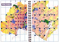
"It has been very convenient, especially for the post office, NEA, Nepal Telecom and the water supply people," says Shyam Mani Gautam from KMC's Information Support Unit. Gautam was part of the team that used Geographic Information System(GIS) to design the Kathmandu street atlas. Converting satellite imagery into a detailed street map of Kathmandu that included schools, temples, monuments and office blocks was not as easy as it sounds. Kathmandu is not in a grid pattern like other planned cities, and because of rapid urbanisation there was also a danger of the atlas becoming quickly outdated.
Regarded as one the Kathmandu Valley Mapping Program's (KVMP) successful initiatives, the Kathmandu street atlas initially aimed at developing and marketing a tourist map of the Valley. Funded by the European Commission, the four-year project was part of the Rs 400 million KVMP project. Besides producing a wall map, KMC also published the 95-page atlas.
This is probably the best and most detailed map of Kathmandu ever published, but unfortunately it is already out of print. We barely managed to get a copy. Last year, KMC printed about 10,000 copies, only to be distribute them free of cost to offices, visitors and even relatives of KMC staff.
KMC had a chance to reprint more last year, but the project has now ended and there is no more funding. The office has included reprint plans for the next fiscal year, but there is no guaranteeing when or if it will be printed.
Although the staff were against free distribution and had suggested marketing the guidebook through local bookshops, senior officers did not support the idea. "Our people are not used to buying maps, so they are being distributed freely instead," says an officer at the KMC. He adds, "It would definitely have been a best seller if we had marketed it through the bookshops."
Several publishers have shown interest in sponsoring the reprint of the book, even giving full credit and copyright to KMC, but the Mayor's office is still undecided over the proposals.


